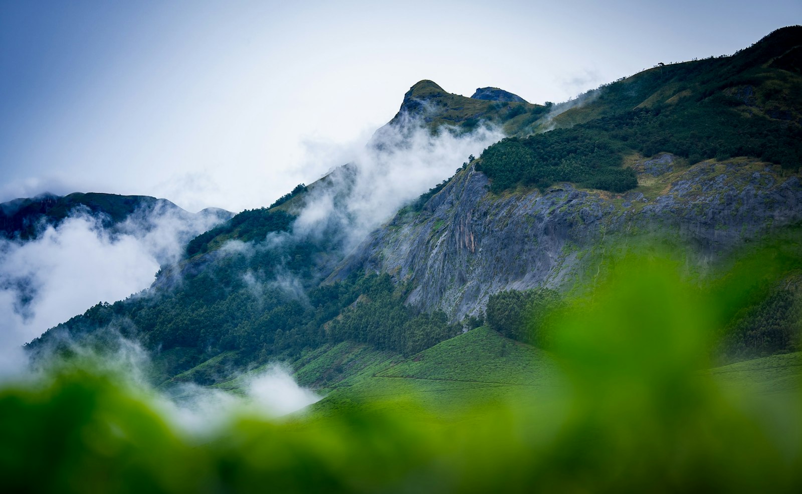
The short answer: give Munnar two or three nights. Spend one morning at Eravikulam National Park to see the Nilgiri tahr, one day on the tea estates and the Tea Museum, and one day driving out to Mattupetty, Kundala and Top Station. Munnar sits at roughly 1,500 to 2,500 metres in the Western Ghats, about 119 km from Cochin International Airport. The closures to plan around: Eravikulam shuts for a few weeks early each year for the tahr calving season, and the famous Neelakurinji bloom is not expected again until 2030.
Munnar is what most people picture when they think of “Kerala hills”: tea bushes clipped into neat green waves, mist pouring over ridges, and roads that never stop climbing. It is also a place that rewards slowing down. Distances look short on a map but take time on mountain roads, the weather changes by the hour, and the best light comes early. This guide covers where Munnar is, what to see, which days and months to avoid for certain sights, and the official links to check before you go. If you are still choosing between hill stations, start with Munnar vs Wayanad.
Where is Munnar, and how high is it?
Munnar is in Idukki district, high in the Western Ghats in the east of Kerala; from Top Station you look down into neighbouring Tamil Nadu. Kerala Tourism describes the town as about 1,600 m above sea level and the wider area as lying between 1,500 and 2,500 m, with average rainfall of about 275 cm a year. The highest peak in the area, Anamudi, rises to 2,695 m; Kerala Tourism calls it the highest point in India outside the Himalayas.
The height is the whole point. Munnar is noticeably cooler than the coast, and visitors from the plains come up to escape the heat. Pack a warm layer and a rain jacket in any season.
How do you get to Munnar?
There is no airport or railway station in Munnar itself. Kerala Tourism lists the nearest airport as Cochin International Airport, about 119 km away, and the nearest major railhead as Ernakulam Junction, about 120 km away. It notes that public buses run to Munnar from almost all the major bus stations in the state, and suggests that international travellers heading straight to Munnar use Ernakulam town, near the airport, as their starting point.
- By bus: KSRTC (the state bus company) runs services up the ghat roads. Check routes and book on the official KSRTC sites linked below.
- By taxi: the easiest option if you land at Kochi with luggage, and the most flexible for stopping at viewpoints and waterfalls on the way up.
- By train plus road: take a train to Ernakulam (or Aluva, which Kerala Tourism names as the nearest station for the Tea Museum), then continue by bus or taxi.
Whichever way you come, budget most of a day for the journey and avoid driving the hill roads after dark, especially in heavy rain. For the bigger picture of airports, trains and interstate buses, see how to get to Kerala, and for local buses and taxis, getting around Kerala without a driver.

What does a 2–3 day Munnar plan look like?
| Day | Morning | Afternoon | Evening |
|---|---|---|---|
| 1: Arrive | Drive or bus up from Kochi | Settle in; short walk through the nearest estate | Early night; the next start is early |
| 2: Eravikulam and tea | Eravikulam National Park (Rajamala) as soon as it opens | KDHP Tea Museum, about 2 km from town | Tea estate walk at golden hour |
| 3: The Top Station road | Mattupetty Dam and lake | Kundala, then Top Station for the views over Tamil Nadu | Back to Munnar, or stay a fourth night |
What is Eravikulam National Park, and when is it closed?
Eravikulam is the reason many people come to Munnar. Kerala Tourism describes a park of about 97 sq km, around 13 km from Munnar town, best known for the Nilgiri tahr, an endangered mountain goat of South India. Around one-third of the world’s population of the species lives in this park, and Anamudi stands inside it.
Visitors do not roam the whole park. Kerala Tourism explains that it is divided into three areas: the Rajamala tourism zone, which is open to visitors, and a core area and buffer area, which are restricted. Kerala Tourism notes that vehicles take visitors up through the hills. If you meet tahr near the path, keep your distance and do not feed or touch them.
The annual calving closure
The park closes to the public every year while the tahr give birth. Kerala Tourism’s own pages describe this window slightly differently: one gives it as “sometime during January–February”, another as February to March. The exact dates are announced each year, so if your trip falls anywhere between January and early April, check before you go and keep a backup plan for that morning.
Hours and tickets
The District Tourism Promotion Council (DTPC) Idukki lists Eravikulam as open 8.00 am to 4.30 pm on all days outside the closure. Arrive early to give yourself the clearest weather and the most time. Ticket prices differ for adults, children and foreign visitors and are revised from time to time, so this guide does not quote them; check the official pages in “Verify the latest” below.
Good to know
Mist can roll over Rajamala within minutes and hide everything, tahr included. If the first morning is a white-out, an extra night in Munnar gives you a second chance, which is one more reason not to rush this town.
When does the Neelakurinji bloom next?
Neelakurinji is a shrub that flowers en masse only once every 12 years, turning whole hillsides blue and purple. Kerala Tourism says the bloom was last seen on the hills of Rajamala in Munnar in 2018, and that the next large flowering in Munnar is likely in 2030. Kerala Tourism names Eravikulam, Rajamala and Top Station as the places to see it.
Smaller, scattered blooms do happen in other years and other parts of Idukki, and they tend to make the news. Treat any “kurinji is blooming” headline with care until the forest department or DTPC confirms where and when, and do not plan a whole trip around one.
How do you see Munnar’s tea estates?
Tea is everywhere in Munnar; you will see it from almost every road and window. The estates are working farms and private property, so stick to roads and marked paths, and ask before you walk into a plantation or photograph workers.
For the story behind the view, visit the KDHP Tea Museum. Kerala Tourism says it was established by Tata Tea in 2005, is officially the Kannan Devan Hills Plantations (KDHP) Tea Museum, and sits in the Nallathanni Estate, about 2 km from Munnar town. There is an entry fee with different rates for adults and children; Kerala Tourism itself advises checking the latest timings and fees before you visit.

What else is worth seeing around Munnar?
| Place | What it is | Distance from Munnar (per Kerala Tourism) |
|---|---|---|
| Eravikulam National Park | Nilgiri tahr, grassland and shola forest, Anamudi | About 13 km |
| KDHP Tea Museum | History of tea in the Kannan Devan hills | About 2 km |
| Attukad waterfall | Waterfall between Munnar and Pallivasal | About 9 km |
| Mattupetty | Dam and lake at about 1,700 m; boating run by DTPC Idukki | About 13 km |
| Kundala | Further along the road from Mattupetty (about 7 km) | About 20 km |
| Top Station | Viewpoint at about 1,700 m looking down into Tamil Nadu | Not stated |
| Chinnar Wildlife Sanctuary | Sanctuary of 90.44 sq km, known for its reptiles | About 60 km |
Mattupetty, Kundala and Top Station
This is one road and one long, lovely day. Kerala Tourism puts Mattupetty a 13 km drive from Munnar, at about 1,700 m, with a dam, a lake and boating run by the DTPC. Kundala is about 7 km beyond Mattupetty. Top Station, also about 1,700 m up, is the viewpoint where the land drops away and the view stretches over Tamil Nadu; it makes a good add-on to the same day, so ask your driver how long the full round trip takes. Mornings are often clearer than afternoons in the hills, so start early.
Chinnar, for a different landscape
If you have an extra day, Chinnar Wildlife Sanctuary, about 60 km from Munnar, is a complete change of scene from the tea hills. Kerala Tourism notes that it has the largest number of reptile species of any sanctuary in the state, along with the Thoovanam waterfall and a watchtower. For how forest permits work in Kerala, see Kerala entry rules.

When is the best time to visit Munnar?
Munnar is a year-round destination, but each season changes the trip:
- After the monsoon and through winter: the most popular window, with clearer skies and green hills. Expect crowds and higher room prices around Christmas, New Year and Indian school holidays.
- Early in the year: watch for the Eravikulam calving closure described above.
- The monsoon: waterfalls are at their fullest and the hills are at their greenest, but views come and go, and heavy rain can disrupt hill roads. Check weather warnings before travelling and avoid driving at night.
For the full year, month by month, see when to visit Kerala.
How do you do Munnar slowly?
- Stay at least two nights. The drive up eats most of a day, and one cloudy morning can wipe out a sight.
- Base yourself outside the town centre if you want quiet, but check how far your stay is from Eravikulam and the Top Station road.
- Do one area a day. Eravikulam on one, Mattupetty, Kundala and Top Station on another. Trying to combine them means hours in a car.
- Carry layers and rain gear, even in the dry months, and keep cash for small entry counters and roadside tea stalls.
- Leave no plastic behind. These are fragile hills and protected forests.
Where do you go after Munnar?
Munnar pairs naturally with Kochi on the way in or out; see the Kochi travel guide for two or three days there. Many visitors then head down to the backwaters around Alappuzha (the backwaters, slowly) to swap mountain air for water. To fit it all together, read how to plan a slow Kerala trip yourself.
Quick answers
How many days do you need in Munnar?
Two full days (three nights if you arrive late) cover Eravikulam, the Tea Museum and the Mattupetty–Top Station road without rushing.
Is Eravikulam National Park open all year?
No. It closes for a few weeks early in the year for the Nilgiri tahr calving season; Kerala Tourism pages give the window as January–February or February–March. Outside that, DTPC Idukki lists it as open 8.00 am to 4.30 pm daily.
When will the Neelakurinji bloom again in Munnar?
Kerala Tourism says the next major flowering in Munnar is likely in 2030, 12 years after the 2018 bloom.
How far is Munnar from Kochi airport?
About 119 km, according to Kerala Tourism. Ernakulam Junction railway station is about 120 km away.
How high is Munnar?
Kerala Tourism puts the town at about 1,600 m and the surrounding area at 1,500 to 2,500 m. Anamudi, inside Eravikulam, reaches 2,695 m.
Verify the latest
- Munnar altitude, rainfall, nearest airport and railhead: Kerala Tourism: Munnar location
- Munnar overview and town altitude: Kerala Tourism: Munnar
- Eravikulam area, Nilgiri tahr, distance from town and calving closure: Kerala Tourism: Eravikulam National Park
- Eravikulam zones, Anamudi height and February–March closure: Kerala Tourism: Eravikulam (destination page)
- Eravikulam visiting hours, ticket rates and contact: DTPC Idukki: Eravikulam National Park
- Forest ecotourism listings and bookings: Kerala Forest Ecotourism
- Anamudi: Kerala Tourism: Anamudi Peak
- Neelakurinji cycle, last and next bloom: Kerala Tourism: Neelakurinji
- KDHP Tea Museum, location and fees: Kerala Tourism: Tea Museum
- Mattupetty and Kundala: Kerala Tourism: Mattupetty
- Top Station: Kerala Tourism: Top Station
- Attukad waterfall: Kerala Tourism: Attukad Waterfall
- Chinnar Wildlife Sanctuary: Kerala Tourism: Chinnar
- KSRTC buses and bookings: KSRTC and KSRTC online booking
- Weather warnings before you drive the hill roads: IMD Thiruvananthapuram
Last checked: 2 November 2026.